


NASA C-20A Flights Support Earthquake Research and NISAR Calibration
- May 12
- 2 min read

NASA has continued its airborne research operations in support of earthquake science and satellite calibration, with the agency’s Gulfstream III completing a series of missions over Central California on April 29. Operating from NASA Armstrong Flight Research Centre, the aircraft carried the sophisticated Uninhabited Aerial Vehicle Synthetic Aperture Radar (UAVSAR) system to collect detailed geophysical data along the San Andreas Fault system.

The latest missions form part of a broader airborne campaign that began in September 2025 and is expected to continue throughout 2026. The flights are designed to improve the accuracy of earthquake modelling in California while also supporting calibration and validation work for the NISAR Earth observation satellite launched jointly by NASA and the Indian Space Research Organisation.

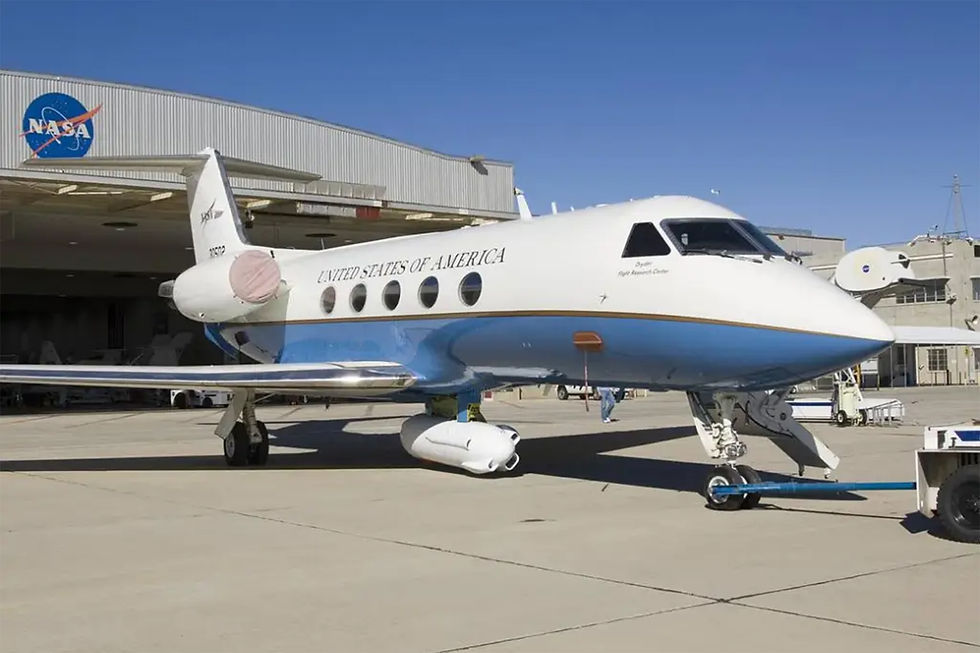
The C-20A, a modified military variant of the Gulfstream III business jet, has become one of NASA’s most versatile airborne science platforms. Its long endurance, high-altitude performance, and ability to carry advanced sensor payloads make it particularly suited to precision geophysical surveys. For these missions, the aircraft was equipped with UAVSAR, an advanced L-band synthetic aperture radar developed by Jet Propulsion Laboratory.

Flying coordinated tracks aligned with NISAR’s orbital passes, the aircraft gathered highly detailed radar measurements of ground deformation across Central California. Researchers are using the data to study subtle crustal movements along the San Andreas Fault, one of the world’s most closely monitored tectonic boundaries. The flights also mapped land subsidence in California’s Central Valley, where extensive groundwater extraction continues to affect surface stability.

From an aviation operations perspective, the missions highlight the growing importance of specialised airborne research aircraft in supporting space-based observation systems. While satellites such as NISAR provide global coverage, aircraft-mounted radar systems offer higher flexibility, targeted data collection, and the ability to validate satellite observations under controlled conditions. UAVSAR’s measurements also help scientists better understand how atmospheric conditions influence radar signals captured from orbit.

The six-month calibration campaign is particularly significant for NISAR’s operational future. The satellite’s radar systems are designed to survey nearly all of Earth’s land and ice surfaces every 12 days, monitoring natural hazards, ecosystem changes, glacier movement, and agricultural activity. Accurate calibration using airborne assets such as the C-20A ensures the satellite can reliably detect minute shifts in Earth’s surface that may indicate increasing seismic risk.

NASA’s continued use of the C-20A also demonstrates how legacy aircraft platforms remain highly valuable in advanced scientific roles. Through extensive modification and integration of cutting-edge sensors, the aircraft provides a flexible and cost-effective platform capable of supporting complex Earth science missions that complement both satellite operations and ground-based monitoring networks.
The Central California flights further underline the increasingly integrated relationship between aviation and Earth observation science, where airborne research assets play a critical role in enhancing the accuracy and usefulness of next-generation spaceborne monitoring systems.


One thing I noticed about eggy car is how smooth it runs even on older laptops. That’s rare for free online games now, and it makes the experience much better.