


“Hurricane Hunters” The 53rd Weather Reconnaissance Squadron
- May 26, 2020
- 9 min read

Aviators as a general rule are taught to avoid sever weather where at all possible, but in the US Air Force there are a small group of aviators that do the exact opposite and during hurricane season they intentionally fly directly into the eye of these monsters. This bunch of specialist are affectionately known as the “Hurricane Hunters”

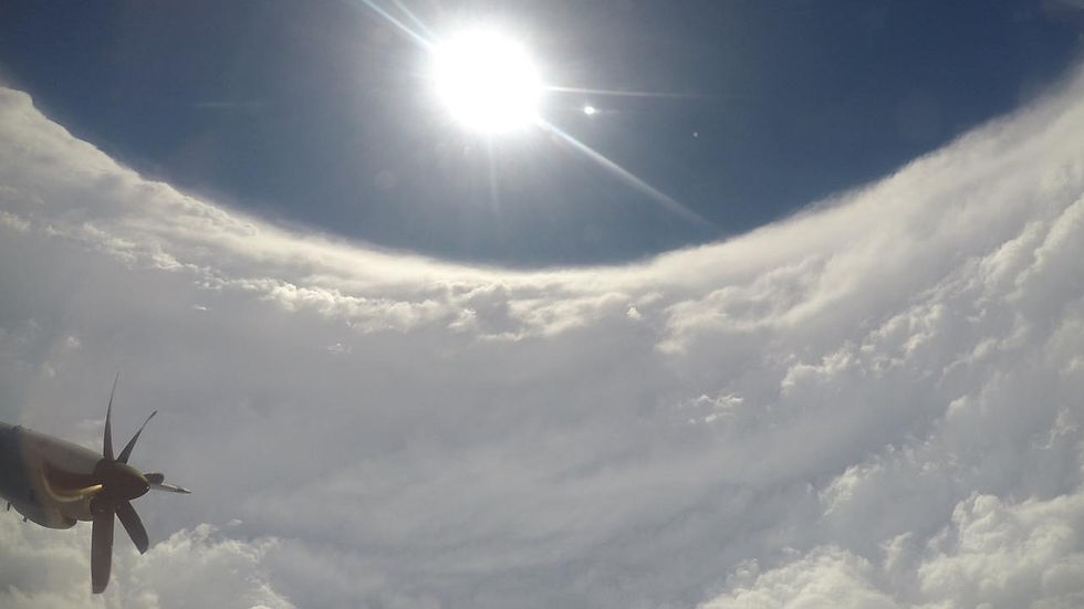
The 53rd Weather Reconnaissance Squadron is a flying unit of the United States Air Force, and "the only Department of Defence organization still flying into tropical storms and hurricanes." Aligned under the 403rd Wing of the Air Force Reserve Command (AFRC) and based at Keesler Air Force Base, Mississippi, with ten aircraft, it flies into tropical cyclones in the Atlantic Ocean, the Caribbean Sea, the Gulf of Mexico and the Central Pacific Ocean for the specific purpose of directly measuring weather data in and around those storms. The 53rd WRS currently operates the Lockheed WC-130J aircraft as its weather data collection platform.

The squadron was activated in 1944 during World War II as the 3rd Weather Reconnaissance Squadron, tracking weather in the North Atlantic between North America and Europe. Redesignated the 53rd Weather Reconnaissance Squadron in 1945, the term "Hurricane Hunters" was first applied to its activities in 1946. The 53rd became a part of the USAF before its inactivation in 1947, was reactivated in 1951 as a long-range weather reconnaissance unit based in Bermuda and England, and since 1963 has been based in the southern United States or in Puerto Rico with its primary mission the measurement of tropical cyclones. The 53rd WRS moved to its present home station at Keesler AFB in 1973, and after being briefly inactivated again between 1991 and 1993, became an Air Force Reserve unit.

The Hurricane Hunters of the Air Force Reserve are distinct from those of the Department of Commerce's NOAA Hurricane Hunters, based at Lakeland Linder International Airport, Florida, who use a pair of Lockheed WP-3D Orion and a Gulfstream IV-SP aircraft to also fly weather reconnaissance, data collection and scientific research missions. In accordance with its memorandum of agreement with NOAA, AFRC maintains a capability in the 53rd WRS for five sorties per day from its home station and two deployed locations in support of requirements for the National Hurricane Operations Plan, or two sorties a day during winter storm seasons. The 53rd also provides a subunit, the Chief, Aerial Reconnaissance Coordination, All Hurricanes ("CARCAH"), at the National Hurricane Centre to coordinate the activities of both organizations.

Concurrent with its operational mission, the 53rd WRS is also tasked with recruiting, organizing and training assigned personnel to perform aerial weather reconnaissance, and its aircrews are qualified to handle tactical airlift missions.

Aerial reconnaissance of tropical storms first began in September 1935. In that year the United States Weather Bureau decentralized its hurricane warning system, which depended to a great extent on reports from ships at sea, opening three warning centrers in San Juan, Puerto Rico; Jacksonville, Florida; and New Orleans, Louisiana. In August the Jacksonville centre followed the progress of a developing hurricane east of the Bahamas, determining that it would pass through the Straits of Florida and strike the north coast of Cuba. It contacted the Cuban weather service when ship information was no longer available, but track of the storm was lost when the Cubans observed no evidence of it. Acting on a report from a Pan American Airlines pilot, a weather observation flight was requested of the Cuban Army Air Corps and on 2 September 1935 its chief training pilot, American expatriate Capt. Leonard J. Povey, volunteered to locate the system. Although he was unable to penetrate the storm in his open-cockpit Curtiss Hawk II biplane, Povey provided information that indicated the hurricane was moving north into the Florida Keys. The destructiveness of the 1935 Labor Day hurricane prompted Povey to recommend a regular aerial hurricane patrol.

The 1943 Surprise Hurricane, which struck Houston during World War II, marked the first intentional meteorological flight into a hurricane. That summer, British pilots being trained as instrument instructor pilots at Bryan Army Airfield heard that the school was evacuating its AT-6 Texan trainers in the face of the oncoming hurricane, and began teasing their instructors about the airworthiness of the aircraft. Instrument flying school commander USAAF Lt. Col. Joseph B. Duckworth, a former airline pilot with Eastern Airlines who had developed instrument procedures for the carrier, bet his RAF students that he could safely fly into the storm and return. On 27 July 1943 he took out one of the trainers with 2nd Lt Ralph M. O'Hair navigating and flew it straight into the eye of the storm. After he returned safely, the base's only weather officer, 1st Lt William H. Jones-Burdick, took over the navigator's seat and Duckworth flew into the storm (now over land) a second time, this time recording their observations and measuring temperatures within the storm. The flights demonstrated that hurricane reconnaissance flights were feasible.

24 days later, on 19 August 1943, the AAF weather station at Waller Field, Trinidad, recorded unusually low pressures and received a similar report from Beane Field on Saint Lucia. Together with a report of high winds to the east from a U.S. Navy aircraft landing at Naval Operating Base Trinidad, the data prompted the first weather reconnaissance mission to locate a previously unreported tropical disturbance, which was flown the next morning. The flight, made by a B-25 Mitchell medium bomber assigned to the 25th Bombardment Group (an anti-submarine unit at nearby Edinburgh Field), proceeded from Waller to Barbados and then due east at altitudes between 600 and 8,000 ft into the heart of Hurricane III of 1943. Using standard navigational position fixes, the mission plotted observations inflight on a chart as they proceeded and transmitted them to Beane Field for relay to Waller and Borinquen Field, Puerto Rico.

The 53rd WRS was activated on 7 August 1944 at Presque Isle Army Air Field, Maine, originally as the 3 WRS. Many of its missions were flown from a forward base at Gander, Newfoundland, using B-25s. Its original mission was to fly weather tracks along aircraft ferry routes between North America and Allied Western Europe. During the 1946 season, when the 53d WRS acquired the Boeing RB-29 Superfortress as its primary aircraft, the term "Hurricane Hunters" was first used to describe its missions. While not an ideal weather reconnaissance platform, the WB-29 proved to be comparatively safe and reliable. The first medium level penetration of a hurricane took place on 19 October 1947 by an RB-29 of the 53d WRS into Hurricane Love near Bermuda, validating penetration of tropical storms at lower altitudes as reasonably safe.

From Gander, the squadron moved to New Hampshire; Florida; Kindley Field, Bermuda; RAF Burtonwood, England, with forward basing at Dhahran, Saudi Arabia; Bermuda for a short time, and Hunter Air Force Base, Georgia. In 1966, now flying the Lockheed WC-130, the 53rd WRS once again left the United States, this time for Ramey Air Force Base, Puerto Rico. When Ramey closed in 1973, the Hurricane Hunters relocated to their present location at Keesler AFB, Mississippi.

On 18 September 1953, while based at Kindley, Bermuda, the squadron suffered its only mission-related loss of an aircraft, a WB-29. Returning to base with a runaway propeller on the inboard engine of the right wing, the propeller separated from its shaft and struck the engine beside it, causing both the wing and outboard engine to catch fire. The pilot ordered an immediate bailout, but the aircraft went out of control and only three of the 10-man crew survived. In 1965 the 53rd WRS became the first squadron of the Air Weather Service to operate the WC-130 after its designation as such, and from Ramey flew the first WC-130 Hurricane Hunter mission on 27 August 1965, penetrating the eye of Hurricane Betsy.
In the 1970s, after its move to Keesler, the 53rd participated in two "firsts" in the changing of regulations to permit women to be qualify as aircrew. Sgt. Vickiann Esposito became the first female dropsonde operator and possibly the first fully qualified aircrew member (excepting flight nurses) in Air Force history, approved by Headquarters Air Force in December 1973 as a waiver of the regulation prohibiting the assignment of women, over the initial objections of the commanding general of the Air Mobility Command. In October 1977, after the regulation had been rescinded, 1st Lt. Florence Fowler became one of the first two women to be rated as navigators.

In 1976, the 815th Tactical Airlift Squadron of the Air Force Reserve, also based at Keesler, was redesignated the 815th Weather Squadron "Storm Trackers" and served as an associate squadron to the 53rd until 1987, when the 815th reverted to a tactical airlift unit because of reduced numbers of WC-130s. The Regular Air Force's 53rd WRS was inactivated in June 1991 for budgetary reasons and its assets and personnel transferred to the 815th TAS, which formed a flight to assume the weather recon mission while continuing its airlift role as well. On 1 November 1993, as a result of the impact of Hurricane Andrew the year before, the 53rd WRS was reactivated as a full-time Air Force Reserve squadron to take over the weather reconnaissance mission from the 815th AS.

The airframes flown by the 53rd WRS were originally built in 1964–65 as C-130H and C-130Es. Hurricane Andrew had also demonstrated a need for upgraded models to continue the Hurricane Hunter mission, and funding for ten replacements was authorized by Congress in FY1998. On 11 October 1999, the 53rd WRS received its first Lockheed WC-130, and flew its first hurricane mission in the new model on 16 November, into Hurricane Lenny. Problems with the new model, primarily damage to its composite material 6-bladed propellers from hail and ice and a lack of sensitivity in its colour radar images, delayed its Initial Operational Capability until just before the 2005 hurricane season. The propeller problem was overcome by bonding a metal sleeve to the leading edge of each blade and the radar issue by changes in the radar software coding.

While in conversion to the new airframe, the unit continued its mission of aerial weather reconnaissance and added a new weather-related mission type in 2003, using the WC-130Js to drop buoys ahead of impending tropical storms. In 2004, the unit started training to support tactical airlift missions in addition to its weather mission. The landfall of Hurricane Katrina on 29 August 2005 caused devastating damage to Keesler. An estimated one-third of the members of the parent 403rd Wing lost a home or had it extensively damaged. Yet the equipment and personnel of the squadron, flying out of Dobbins Air Reserve Base near Atlanta, Georgia when the hurricane struck, never missed a tasked mission during Katrina or follow-up storms.

The operations of the 53rd WRS were affected by the federal budget sequestration of 2013. Furloughs of personnel, amounting to two days in every pay period per member, resulted in a 20% cut in capability, according to the wing commander of the 403rd Wing on 24 July 2013. While sequestration was in effect, this meant the squadron was capable of working only two storms simultaneously at full mission scheduling instead of the normal three, and that pace sustainable only for five or six days.

The 53rd Weather Reconnaissance Squadron, using the call signs Teal 70 to Teal 79, flies missions into hurricanes and weather systems for research purposes and observation. Although satellite data has revolutionized weather forecasters' ability to detect early signs of tropical cyclones before they form, there are still many important tasks for which this information is not suitable. Satellites cannot determine the interior barometric pressure of a hurricane, nor provide accurate wind speed information. This data is needed to accurately predict hurricane development and movement. Because satellites cannot collect the data and ships are too slow and vulnerable, the only viable way to collect this information is with aircraft.

2020 seems to be gearing up to be a busy year for the Hurricane Hunters, although hurricane season doesn’t officially start until June 1. The Air Force Reserve Command’s Hurricane Hunters departed on their first storm tasking of the 2020 Atlantic hurricane season to investigate an area for possible development into a tropical depression or storm near the Bahamas. The 53rd Weather Reconnaissance Squadron is expected to fly into Invest 90L throughout the weekend to provide weather data by satellite communication to the National Hurricane Enter in Miami to improve their computer models that forecast movement and intensity, said Lt. Col. Anthony Wilmot, 53rd WRS director of operations.

According to the NHC, there is a 70% chance that this area of interest could form into Tropical Storm Arthur over the weekend. This would be the sixth consecutive year with a named storm in May. “Mother Nature doesn’t operate on a calendar, so this is a reminder to always be prepared,” said Col. Jeffrey A. Van Dootingh, 403rd Wing commander. “On that note, the 53rd WRS is prepared, ready and able to meet these storm taskings to provide valuable information to the NHC which can help save lives and property.” The Hurricane Hunters are conducting an investigation mission. A low-level invest mission is flown at 500 to 1,500 ft to determine if there is a closed circulation. If there is a closed circulation, they begin flying fix missions into the system, Wilmot said.

Once a system becomes a tropical storm or hurricane, the Hurricane Hunters begin flying at higher altitudes, ranging from 5,000 to 10,000 feet depending on the severity of the storm. Aircrews fly through the eye of a storm four to six times per mission to locate the low-pressure centre and circulation of the storm. During each pass through the centre, they release dropsondes, which collect pressure, temperature, relative humidity and wind speeds on its descent to the ocean surface. During the invest and storm flights, the aircrews transmit weather data collected from the dropsondes and aircraft sensors via satellite communication every 10 minutes to the NHC to assist them with their forecasts and storm warnings.
Forecasters have projected this hurricane season to be more active than usual. However, whether it’s a busy or slow season, it only takes one devastating storm to make it a bad year for a community, so it’s important to be prepared.


Comments